The University of New South Wales

go to UNSW home page

Handbook Home

PRINT THIS PAGE
Field Methods and Mapping - GEOS3131
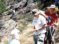
 geology image


Campus: Kensington Campus
 
 
Career: Undergraduate
 
 
Units of Credit: 6
 
 
EFTSL: 0.12500 (more info)
 
 
Indicative Contact Hours per Week: 4
 
 
Enrolment Requirements:
 
 
Pre-requisites: GEOL1111/GEOS1111 or GEOL1211/GEOS1211 or GEOS1701
 
 
Fee Band: 2 (more info)
 
 
Further Information: See Class Timetable


Description

This course provides opportunity to undertake an extended field mapping exercise in a seleted area of the state. The course will cover practical geological mapping techniques, general field skills, and the integration of stratigraphic, lithological, structural and palaeontological concepts. Use of remote sensed and geophysical imagery of the area to be mapped will be included. This course may be run in conjuction with other universities.

Note/s: A field mapping camp, up to 6 days in duration, forms the principal component of the course and students will incur some personal costs.

URL for this page:

© The University of New South Wales (CRICOS Provider No.: 00098G), 2004-2011. The information contained in this Handbook is indicative only. While every effort is made to keep this information up-to-date, the University reserves the right to discontinue or vary arrangements, programs and courses at any time without notice and at its discretion. While the University will try to avoid or minimise any inconvenience, changes may also be made to programs, courses and staff after enrolment. The University may also set limits on the number of students in a course.